
Specializējamies digitālo karšu un to publicēšanas risinājumu izstrādē, telpisko datu veidošanā, uzturēšanā un apstrādē, kā arī apjomīgu ģeogrāfiskās informācijas sistēmu (ĢIS) projektu realizācijā.
Esam īsti Latvijas ĢIS profesionāļi ar daudzu gadu pieredzi nozarē, ko apliecina mūsu ilggadīgi veidotā un uzturētā Latvijas ĢIS datubāze.
Dažādu GPS sekošanas pakalpojumu iespējas jau no 2008. gada
GPS sekošanas sistēma autoparku uzraudzībai
Plaša pieredze dažādu sporta un tūrisma pasākumu karšu radīšanā
Pieejama precīza ĢIS datubāze par visu Latvijas teritoriju vektordatu formātā
Sena pieredze darbā ar populārākajām komerc-licenču ĢIS programmatūrām
Spēja darbam pielāgot atvērtā koda ĢIS programmatūru un karšu publicēšanas serverus
Pilns ĢIS sistēmas dizains, modelēšana un izstrāde, iekļaujot datus, to apstrādi, uzturēšanu un publicēšanu
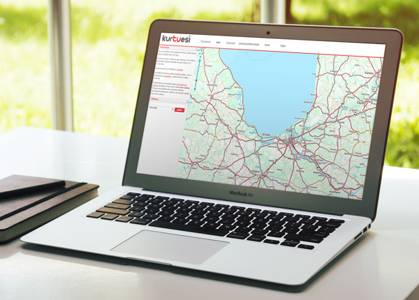
Kurtuesi.lv ir publisks, brīvi pieejams interneta karšu portāls, kas nodrošina visu Latvijas Republikas adrešu, pilsētu, ciemu un ezeru meklēšanu. Portāls ir vienlaicīgi arī SIA Maplant uzturētā GPS sekošanas sistēma autoparkiem. Kartes pamatne ir savietojama ar citiem karšu pārlūkiem. Latvijas ceļu dati mērogā 1:10 000!
Apmeklēt lapumaplant@maplant.lv
+371 22057777